Premium broadband and next-generation Earth-observation intelligence for governments, enterprises, and communities across the continent.

Premium satellite-backed broadband for enterprise and rural expansion.

Fast, reliable consumer-grade satellite broadband.

Shared community Wi-Fi powered by satellite.

Rapid-access mapping intelligence.

On-demand geospatial analytics for decision-makers.

Satellite-enabled agricultural intelligence.

Risk and climate insight dashboards.

Climate trend tracking & environmental monitoring.

Advanced spatial analysis toolkit.

Sovereign-grade Earth observation solutions.

Capacity building & EO skills development.
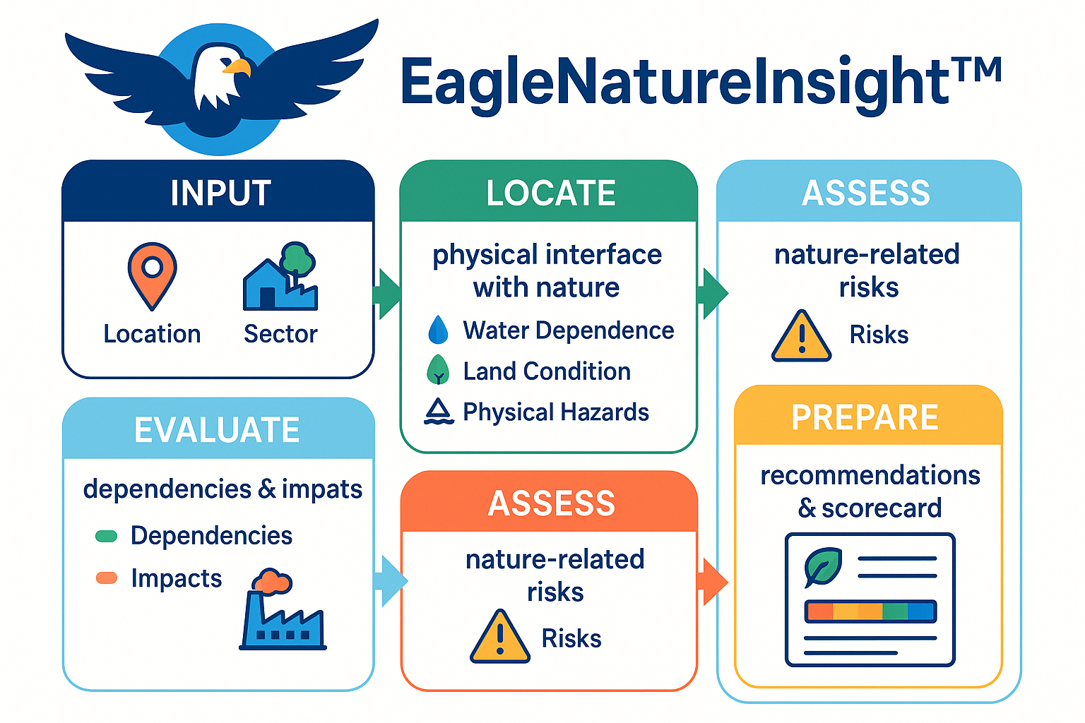
TNFD-aligned nature intelligence and risk scorecards for SMEs.